1960
SH5550 : Bwlch-y-Ddwy-elor - 1960
taken 64 years ago, 3 km from Ffridd Uchaf, Gwynedd, Wales
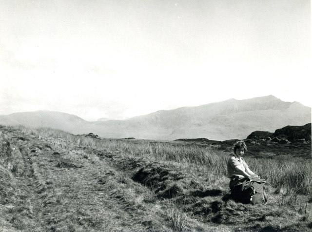
Bwlch-y-Ddwy-elor - 1960
Looking northeast from the Pass of the Two Biers [the English version of the name] towards Snowdon. There is presumably a story about how the pass got its name, but I have not found it.
 Map © Crown Copyright")
TIP: Click the map for more Large scale mapping
- Grid Square
- SH5550, 23 images (more nearby 🔍)
- Photographer
- M J Richardson (more nearby)
- Date Taken
- April 1960 (more nearby)
- Submitted
- Friday, 13 July, 2012
- Subject Location
-
OSGB36:
 SH 553 505 [100m precision]
WGS84: 53:1.9353N 4:9.5213W - Camera Location
-
OSGB36: SH 552 503
- View Direction
- Northeast (about 45 degrees)