2012
SU2991 : Maize crop, south of Fernham
taken 12 years ago, near to Fernham, Oxfordshire, England
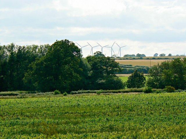
Maize crop, south of Fernham
The maize will probably end up as cattle fodder rather than popcorn. Beyond is a small area of woodland unnamed on the maps. On the skyline are the unmistakable outlines of the five wind turbines of Westmill Energy Farm, over five kilometres west of the viewpoint.
 Map © Crown Copyright")
TIP: Click the map for more Large scale mapping
- Grid Square
- SU2991, 43 images (more nearby 🔍)
- Photographer
- Brian Robert Marshall (more nearby)
- Date Taken
- Tuesday, 17 July, 2012 (more nearby)
- Submitted
- Wednesday, 18 July, 2012
- Subject Location
-
OSGB36:
 SU 293 914 [100m precision]
WGS84: 51:37.2612N 1:34.6124W - Camera Location
-
OSGB36: SU 299 914
- View Direction
- WEST (about 270 degrees)