NM9101 : Loch Gainmheach
taken 12 years ago, 3 km from Finchairn, Argyll And Bute, Scotland
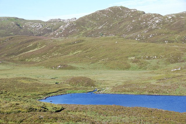
The Ederline hydro scheme is situated near Ederline, to the south of Loch Awe. The site lies approximately 15 kilometres north of Lochgilphead and 20 kilometres west of Inveraray. An intake on the Finchairn River just south of Loch Finchairn will feed into an aqueduct that will divert water into Loch nan Ceard Mor. A dam at the southern end of Loch Gainmheach will raise the water level in Loch Gainmheach and Loch nan Ceard Mor to provide storage for the scheme. Water will be abstracted from an intake at the northern end of Loch nan Ceard Mor and transferred to a Powerhouse adjacent to the B840 near Finchairn Farm House.
The principal components of the generating station are as described in the Environmental Statement and will include:
2 intakes; intake 1 diverting water from Finchairn Loch to Loch nan Ceard Mor and intake 2 diverting water from loch nan Ceard Mor to the powerhouse
A dam; to raise the water level in Loch Gainmheach
Powerhouse building;
Tailrace with 2 outfalls; one just below the powerhouse and the other at the mouth of the Finchairn River at Loch Awe.
A buried pipeline;
Permanent tracks to the pipeline, the aqueduct and the dam.
The surface of Loch Gainmheach lies only about 1.5m lower than the surface of Loch nan Ceard Mor. Raising the water level on Loch Gainmheach will create a much larger body of water, effectively reversing the flow back upstream. One consequence of this will be the flooding of the original ford on the Lochaweside to Lochfyneside drove road, although this will be replaced by a landrover bridge. The line of the drove road from Kilenuar to its junction with the new access road to the dam on Loch Gainmheach has been upgraded, which has improved access to fishing on the hill lochs and stalking on the estate.
More information on the scheme can be found on the Scottish Governments website Linkand at Argyll and Bute Councils website Link
 Map © Crown Copyright")
- Grid Square
- NM9101, 56 images (more nearby 🔍)
- Photographer
- Patrick Mackie (more nearby)
- Date Taken
- Thursday, 26 July, 2012 (more nearby)
- Submitted
- Saturday, 28 July, 2012
- Subject Location
-
OSGB36:
 NM 9179 0146 [10m precision]
WGS84: 56:9.6122N 5:21.2709W - Camera Location
-
OSGB36: NM 9157 0141
- View Direction
- East-northeast (about 67 degrees)