2012
SK2057 : Lime Kiln, beside Minninglow Embankment
taken 12 years ago, near to Pikehall, Derbyshire, England
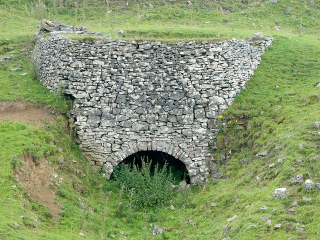
Lime Kiln, beside Minninglow Embankment
 Map © Crown Copyright")
TIP: Click the map for more Large scale mapping
- Grid Square
- SK2057, 82 images (more nearby 🔍)
- Photographer
- Rob Howl (more nearby)
- Date Taken
- Sunday, 12 August, 2012 (more nearby)
- Submitted
- Monday, 13 August, 2012
- Subject Location
-
OSGB36:
 SK 205 572 [100m precision]
WGS84: 53:6.7387N 1:41.6313W - Camera Location
-
OSGB36: SK 205 573
- View Direction
- Southeast (about 135 degrees)