2012
SP0412 : Disused airstrip, Chedworth airfield
taken 12 years ago, near to Chedworth, Gloucestershire, England
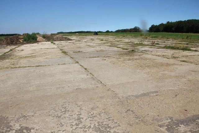
Disused airstrip, Chedworth airfield
Chedworth was an RAF base during World War 2. This is the eastern end of the main airstrip. A little further west, the airstrip has been broken up and has been returned to farmland. Further west still, much of the old airstrip is still there, although somewhat broken up, and a cross strip running almost north to south crosses this strip and has much of the original surface remaining.
 Map © Crown Copyright")
TIP: Click the map for more Large scale mapping
- Grid Square
- SP0412, 45 images (more nearby 🔍)
- Photographer
- Terry Jacombs (more nearby)
- Date Taken
- Friday, 10 August, 2012 (more nearby)
- Submitted
- Tuesday, 14 August, 2012
- Subject Location
-
OSGB36:
 SP 0471 1292 [10m precision]
WGS84: 51:48.8935N 1:55.9847W - Camera Location
-
OSGB36: SP 0474 1291
- View Direction
- West-northwest (about 292 degrees)