2012
C9342 : The River Bush near Bushfoot (4)
taken 12 years ago, near to Portballintrae, Co Antrim, Northern Ireland
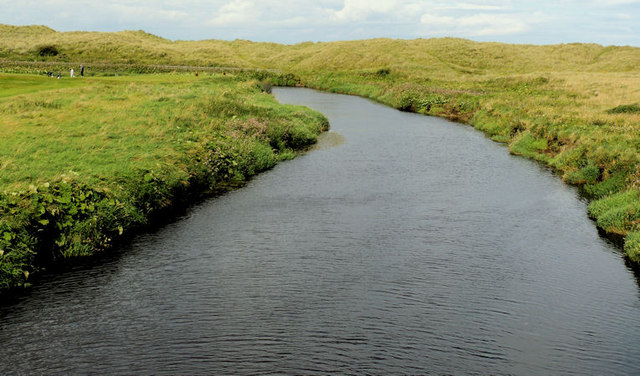
The River Bush near Bushfoot (4)
The River Bush, looking downstream, from the footbridge beside the Giants Causeway Railway bridge C9342 : Railway bridge near Portballintrae. Part of Bushfoor golf course Link is on the left.
The River Bush, Co Antrim
The Bush rises in the Antrim Hills near Clontyfinnan Bridge. It enters the Atlantic at Bushfoor near Portballantrae after passing through Armoy, Stranocum and Bushmills.
Sand dunes and paths, Portballintrae
There are many paths through the sand dunes, to the east of Portballintrae. They start at the car park on the Beach Road and continue crossing the Bush, towards Runkerry. This collection of photographs shows the paths, the views and some of the wildflowers found among the dunes. The Google map is representational only. It does not coincide with the satellite photograph.
Loading map... (JavaScript required)
- Grid Square
- C9342, 91 images (more nearby 🔍)
- Photographer
- Albert Bridge (more nearby)
- Date Taken
- Tuesday, 14 August, 2012 (more nearby)
- Submitted
- Thursday, 16 August, 2012
- Subject Location
-
Irish:
 C 936 424 [100m precision]
WGS84: 55:13.2340N 6:31.7456W - Camera Location
-
Irish: C 936 424
- View Direction
- Northwest (about 315 degrees)