2012
C8138 : Depth marker, Portstewart harbour
taken 12 years ago, near to Portstewart, Co Londonderry, Northern Ireland
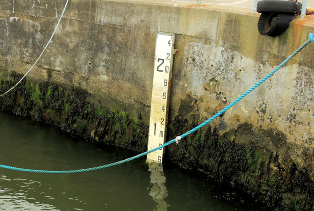
Depth marker, Portstewart harbour
The marker showing the depth of water available at Portstewart harbour. The photograph was taken approximately 3½ hours before high water Portrush.
Loading map... (JavaScript required)
- Grid Square
- C8138, 299 images (more nearby 🔍)
- Photographer
- Albert Bridge (more nearby)
- Date Taken
- Tuesday, 4 September, 2012 (more nearby)
- Submitted
- Saturday, 8 September, 2012
- Subject Location
-
Irish:
 C 815 385 [100m precision]
WGS84: 55:11.2295N 6:43.2653W - Camera Location
-
Irish: C 815 385
- View Direction
- Southwest (about 225 degrees)