TQ9037 : St Mary the Virgin church, High Halden
taken 12 years ago, near to High Halden, Kent, England
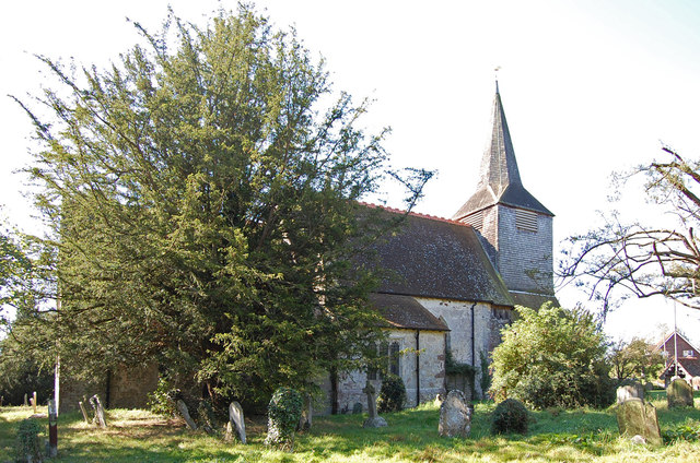
Grade I listed.
The church consists of nave, chancel, south aisle and South chapel from the 15th century, and north chapel which now houses the organ. There is a wooden western tower, circa 1300, with scissor trusses, shingled outside with a shingle spire above. The ground floor of the tower is octagon shaped with entrance lobby, vestry to the north and tower stairs to the south. The nave is Norman and the chancel is 14th century as is the south porch and crown post roof to nave and aisle.
The font is early 13th century with the square bowl of Kentish rag.
The chancel arch was rebuilt early in the 14th century when the old one was collapsing. There is a squint from the north chapel and also one from south chapel.
The south aisle has a three bay arcade of perpendicular style with Bethersden marble bases used as seats originally. They are of a high standard and similar to some in Canterbury Cathedral.
In the 1990s the chancel floor showed signs of subsidence this was caused by vaults beneath the chancel floor, the faults were filled in but further subsidence has occurred since then. The church is awaiting funding for repairs.
There are six bells, the oldest from the early 17th century. There are several windows dating from the 13th to the 15th century.
The churchyard contains oven tombs similar to those at St Margaret's Church Bethersden. see TQ9240 : Oven Vaults, St Margaret's church, Bethersden
 Map © Crown Copyright")
- Grid Square
- TQ9037, 107 images (more nearby 🔍)
- Photographer
- Julian P Guffogg (more nearby)
- Date Taken
- Sunday, 9 September, 2012 (more nearby)
- Submitted
- Tuesday, 11 September, 2012
- Subject Location
-
OSGB36:
 TQ 9017 3723 [10m precision]
WGS84: 51:6.1695N 0:42.8947E - Camera Location
-
OSGB36: TQ 9017 3725
- View Direction
- South-southwest (about 202 degrees)