2012
SJ8497 : Rochdale Canal, Lock#88
taken 12 years ago, near to Manchester, England
This is 1 of 6 images, with title starting with Rochdale Canal, Lock in this square
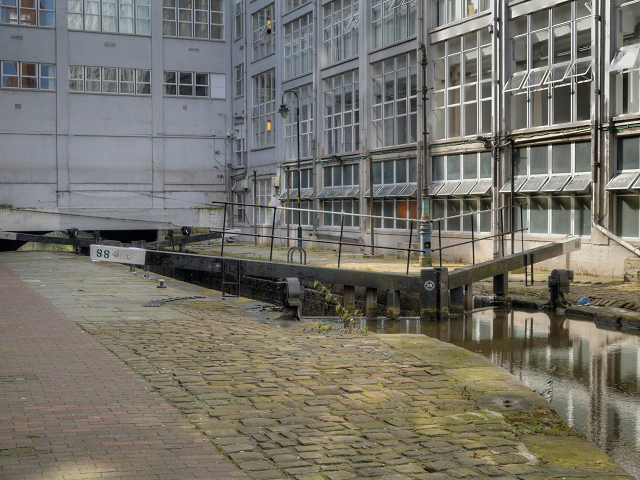
Rochdale Canal, Lock#88
Lock#88 is almost surrounded by buildings at the back of Oxford Street.
Lock#88 is one of the "Rochdale Nine". When the rest of the Rochdale Canal was closed to navigation in 1952, these nine locks which link the Ashton and Bridgewater Canals, through the centre of Manchester, were the only part of the canal to remain open, forming part of the "Cheshire Ring".
Lock#88 is one of the "Rochdale Nine". When the rest of the Rochdale Canal was closed to navigation in 1952, these nine locks which link the Ashton and Bridgewater Canals, through the centre of Manchester, were the only part of the canal to remain open, forming part of the "Cheshire Ring".
Rochdale Canal
The Rochdale Canal runs for 33 miles between Manchester and Sowerby Bridge in West Yorkshire, UK. In Sowerby Bridge it connects with the Calder and Hebble Navigation. In Manchester it connects with the Ashton and Bridgewater Canals.
The canal was opened between Sowerby Bridge and Todmorden and from Manchester to Rochdale in 1799 and between Todmorden and Rochdale in 1805. Most of the canal was closed in 1952. Restoration work began in late 1980s and by 1996 the canal was opened to navigation once again between Sowerby Bridge and the summit level. The canal was re-opened to navigation along its entire length in July 2002 and forms part of the South Pennine Ring.
Link
 Map © Crown Copyright")
TIP: Click the map for more Large scale mapping
- Grid Square
- SJ8497, 2109 images (more nearby 🔍)
- Photographer
- David Dixon (more nearby)
- Date Taken
- Saturday, 15 September, 2012 (more nearby)
- Submitted
- Sunday, 16 September, 2012
- Subject Location
-
OSGB36:
 SJ 8409 9765 [10m precision]
WGS84: 53:28.5201N 2:14.4705W - Camera Location
-
OSGB36: SJ 8413 9766
- View Direction
- West-southwest (about 247 degrees)