2012
SP0987 : Grand Union Canal near Saltley, Birmingham
taken 12 years ago, near to Birmingham, England
This is 1 of 7 images, with title Grand Union Canal near Saltley, Birmingham in this square
Grand Union Canal near Saltley, Birmingham
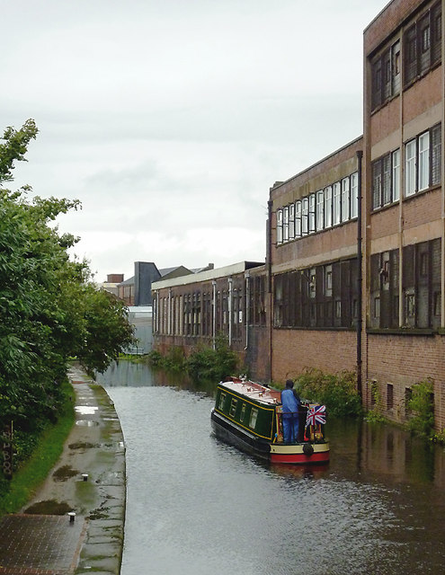
Along the former Birmingham and Warwick Junction Canal, a narrowboat continues northwards through an industrial landscape on a wet day, having negotiated Garrison Middle Lock No 61. The factories on the right include the Saltley Industrial Centre in Adderley Road.
Travelling north from Bordesley Junction, the flight of five Garrison Locks allows a fall of 34ft 5in (10·3 metres) towards Salford Junction Junction, where the canal meets the Tame Valley and Birmingham and Fazeley Canals.
Wikipedia describes how it was on this 2·5 mile link canal sometimes called the Saltley Cut:
... "was reviled as the filthiest place on the whole canal system, with gas works, a power station, railway works and a chemical works all generating or receiving cargoes, and discharging waste into the canal ..."
 Map © Crown Copyright")
TIP: Click the map for more Large scale mapping
- Grid Square
- SP0987, 164 images (more nearby 🔍)
- Photographer
- Roger D Kidd (more nearby)
- Date Taken
- Wednesday, 29 August, 2012 (more nearby)
- Submitted
- Saturday, 22 September, 2012
- Subject Location
-
OSGB36:
 SP 093 874 [100m precision]
WGS84: 52:29.0902N 1:51.8193W - Camera Location
-
OSGB36: SP 093 873
- View Direction
- North-northeast (about 22 degrees)