2012
NH5149 : Cleared forest, by Upper Ardnagrask
taken 12 years ago, near to Ardnagrask, Highland, Scotland
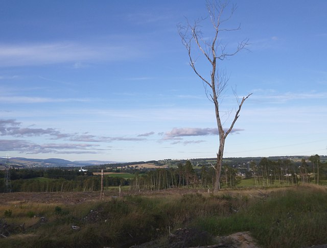
Cleared forest, by Upper Ardnagrask
This area is marked on the map as a forest, named "Birch Wood". It looks like it has been cleared fairly recently, leaving a few dead trees still standing.
There is now a good view towards the outskirts of Muir of Ord. The large white building to the left is part of the Glen Ord Distillery, with the Cromarty Firth just visible beyond it.
There is now a good view towards the outskirts of Muir of Ord. The large white building to the left is part of the Glen Ord Distillery, with the Cromarty Firth just visible beyond it.
 Map © Crown Copyright")
TIP: Click the map for more Large scale mapping
- Grid Square
- NH5149, 13 images (more nearby 🔍)
- Photographer
- Craig Wallace (more nearby)
- Date Taken
- Saturday, 22 September, 2012 (more nearby)
- Submitted
- Sunday, 23 September, 2012
- Subject Location
-
OSGB36:
 NH 5131 4945 [10m precision]
WGS84: 57:30.6448N 4:29.0199W - Camera Location
-
OSGB36: NH 51297 49435
- View Direction
- Northeast (about 45 degrees)