2012
SP0886 : Grand Union Canal at Bordesley Junction, Birmingham
taken 12 years ago, near to Birmingham, England
This is 1 of 2 images, with title Grand Union Canal at Bordesley Junction, Birmingham in this square
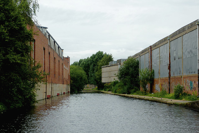
Grand Union Canal at Bordesley Junction, Birmingham
Looking towards Digbeth and Typhoo Basin. This was the Warwick and Birmingham Canal, ceremonially opened on the 19th December 1799. Bordesley Junction is where the short branch to Salford Junction (The Saltley Cut - The Birmingham and Warwick Junction Canal) went off to the north-east. The industrial buildings on the right appear disused at present.
 Map © Crown Copyright")
TIP: Click the map for more Large scale mapping
- Grid Square
- SP0886, 355 images (more nearby 🔍)
- Photographer
- Roger D Kidd (more nearby)
- Date Taken
- Tuesday, 21 August, 2012 (more nearby)
- Submitted
- Sunday, 23 September, 2012
- Subject Location
-
OSGB36:
 SP 084 864 [100m precision]
WGS84: 52:28.5701N 1:52.6645W - Camera Location
-
OSGB36: SP 084 864
- View Direction
- North-northwest (about 337 degrees)