2012
TQ7669 : Travelling Crane, Chatham Docks
taken 12 years ago, near to Brompton, Medway, England
Travelling Crane, Chatham Docks
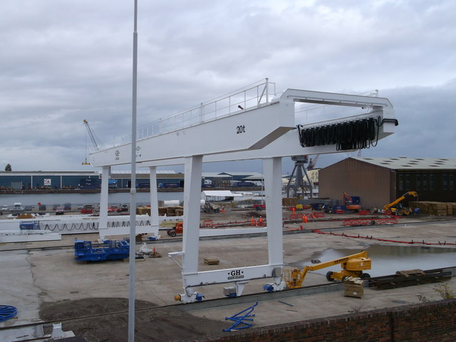
As seen from a footbridge over the A289 Pier Road.
This crane on rails has been assembled beside Basin 3 of the docks.
Behind the crane more rails are being constructed, and another crane has to be assembled.
This crane on rails has been assembled beside Basin 3 of the docks.
Behind the crane more rails are being constructed, and another crane has to be assembled.
Chatham Dockyard :: TQ7569
The Chatham Dockyard's history dates back to 16th century and earlier. For centuries it was at the forefront of shipbuilding, and industrial and architectural technology and for 414 years, it provided over 500 ships to the Royal Navy. At its height the site covered over 400 acres.
The dockyard closed in 1984, and the now a 84 acre section of the site is a visitor attraction managed by the Chatham Historic Dockyard
Trust.
Wikipedia Link
 Map © Crown Copyright")
TIP: Click the map for more Large scale mapping
- Grid Square
- TQ7669, 402 images (more nearby 🔍)
- Photographer
- David Anstiss (more nearby)
- Date Taken
- Friday, 28 September, 2012 (more nearby)
- Submitted
- Monday, 1 October, 2012
- Subject Location
-
OSGB36:
 TQ 7699 6972 [10m precision]
WGS84: 51:23.9340N 0:32.5750E - Camera Location
-
OSGB36: TQ 7697 6969
- View Direction
- Northeast (about 45 degrees)