2012
SK8278 : Danger sunken island keep left
taken 12 years ago, near to Torksey, Lincolnshire, England
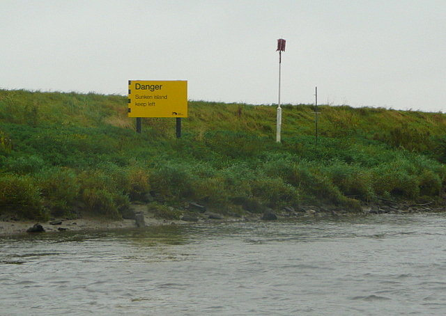
Danger sunken island keep left
The warning signs on this section of the river are very clear and very explicit. This may not affect our shallow-drafted narrowboat, but as we are travelling on the ebb tide we are keeping well into the channel anyway. The red marker indicates the normal edge of the river and would be visible in times of flood. They are green triangles on the other bank.
 Map © Crown Copyright")
TIP: Click the map for more Large scale mapping
- Grid Square
- SK8278, 27 images (more nearby 🔍)
- Photographer
- Graham Horn (more nearby)
- Date Taken
- Monday, 24 September, 2012 (more nearby)
- Submitted
- Tuesday, 2 October, 2012
- Subject Location
-
OSGB36:
 SK 824 782 [100m precision]
WGS84: 53:17.6617N 0:45.9130W - Camera Location
-
OSGB36: SK 8244 7827
- View Direction
- South-southeast (about 157 degrees)