2012
SY4491 : Monarch's Way west of Eype Mouth
taken 12 years ago, near to Eype, Dorset, England
This is 1 of 2 images, with title Monarch's Way west of Eype Mouth in this square
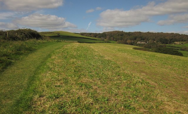
Monarch's Way west of Eype Mouth
The Way, using Footpath W18/34 as does the coast path, climbs the edge of a field. The coast is temporarily out of sight but the clifftop is close by to the left. Ahead is Bailey Copse.
 Map © Crown Copyright")
TIP: Click the map for more Large scale mapping
- Grid Square
- SY4491, 148 images (more nearby 🔍)
- Photographer
- Derek Harper (more nearby)
- Date Taken
- Saturday, 29 September, 2012 (more nearby)
- Submitted
- Wednesday, 3 October, 2012
- Subject Location
-
OSGB36:
 SY 4443 9122 [10m precision]
WGS84: 50:43.0762N 2:47.3113W - Camera Location
-
OSGB36: SY 4445 9121
- View Direction
- West-northwest (about 292 degrees)