2012
SD4377 : Kent estuary at Blackstone Point
taken 12 years ago, near to Arnside, Cumbria, England
This is 1 of 3 images, with title Kent estuary at Blackstone Point in this square
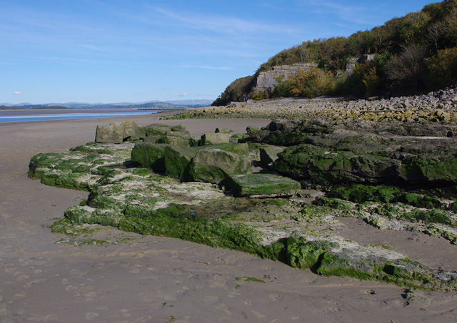
Kent estuary at Blackstone Point
At low tide. Some quarried limestone blocks lie abandoned on the natural outcrop.
The Kent viaduct is in the distance.
The Kent viaduct is in the distance.
 Map © Crown Copyright")
TIP: Click the map for more Large scale mapping
- Grid Square
- SD4377, 47 images (more nearby 🔍)
- Photographer
- Ian Taylor (more nearby)
- Date Taken
- Sunday, 7 October, 2012 (more nearby)
- Submitted
- Friday, 12 October, 2012
- Subject Location
-
OSGB36:
 SD 4372 7770 [10m precision]
WGS84: 54:11.5176N 2:51.8426W - Camera Location
-
OSGB36: SD 4372 7770
- View Direction
- East-northeast (about 67 degrees)