2012
SX9373 : Fore Street Bridge replaced
taken 12 years ago, near to Teignmouth, Devon, England
Fore Street Bridge replaced
Road surfacing remained to be completed, and the scaffolding support for the temporary utilities removed but, basically, job done.
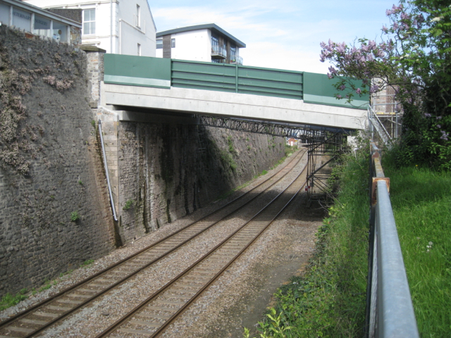
Fore Street bridge, Teignmouth
Fore Street bridge, once a principal route over the railway and into the town, has carried local traffic since the realignment of the A379 in the late 1980s. Consulting engineers for Network Rail, Arup, had identified unacceptable weakness in the girders supporting the carriageway together with overloading in the parapet girders. The only solution was to dismantle the bridge (which may date from the time Brunel's GWR was scythed through the town) and install a new, stronger one. The major part of the work was carried out over the weekend of 18-19 February 2012 in a highly organised operation.
Information taken from Network Rail's Prior Approval Application to Teignbridge District Council, TCP 10/049, 20 December 2011, with thanks.
 Map © Crown Copyright")
TIP: Click the map for more Large scale mapping
- Grid Square
- SX9373, 493 images (more nearby 🔍)
- Photographer
- Robin Stott (more nearby)
- Date Taken
- Sunday, 6 May, 2012 (more nearby)
- Submitted
- Wednesday, 17 October, 2012
- Subject Location
-
OSGB36:
 SX 9396 7304 [10m precision]
WGS84: 50:32.8486N 3:29.8819W - Camera Location
-
OSGB36: SX 9393 7302
- View Direction
- East-northeast (about 67 degrees)