2012
SH7157 : Llynnau Mymbyr
taken 12 years ago, near to Capel Curig, Conwy, Wales
This is 1 of 24 images, with title Llynnau Mymbyr in this square
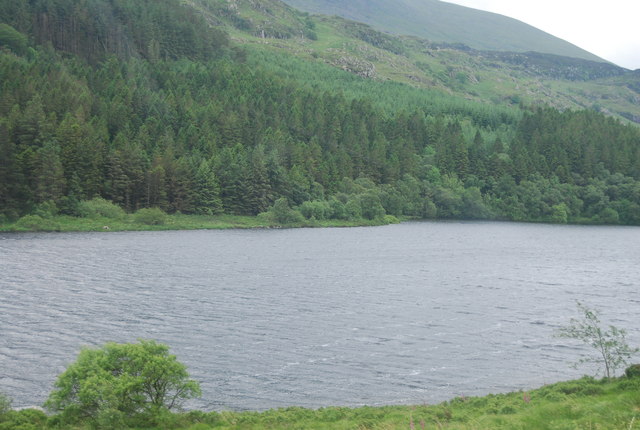
Llynnau Mymbyr
Llynnau Mymbyr are two lakes located in Dyffryn Mymbyr, a valley running from the village of Capel Curig to the Pen-y-Gwryd hotel in Snowdonia, north-west Wales. The A4086 runs along their northern banks.
This is one lake, originally called Llyn Mymbyr, with a maximum depth of 30 feet. About 3/4 mile long in total, a delta has built up midway along the north shore, and this has to all purposes cut the lake in two - hence the plural name.
The river feeding the lakes is the Nantygwryd, which has its source at Llyn Cwm-y-ffynnon, also marked on maps as the Nant Gwryd, which is a tributary of the Afon Llugwy. The two rivers join at Capel Curig.
See other images of Llynnau Mymbyr
 Map © Crown Copyright")
TIP: Click the map for more Large scale mapping
- Grid Square
- SH7157, 108 images (more nearby 🔍)
- Photographer
- N Chadwick (more nearby)
- Date Taken
- Sunday, 24 June, 2012 (more nearby)
- Submitted
- Friday, 19 October, 2012
- Subject Location
-
OSGB36:
 SH 7109 5757 [10m precision]
WGS84: 53:5.9827N 3:55.6081W - Camera Location
-
OSGB36: SH 7112 5778
- View Direction
- SOUTH (about 180 degrees)