2012
NZ6701 : The former Rosedale Railway, north of Cross Gill
taken 11 years ago, 4 km NNE of Church Houses, North Yorkshire, England
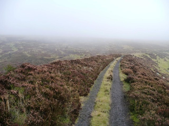
The former Rosedale Railway, north of Cross Gill
Built in 1865 to serve the Rosedale East ironstone mines, and closed in 1929. Now a well-used footpath and cycle route. See Link for more information
 Map © Crown Copyright")
TIP: Click the map for more Large scale mapping
- Grid Square
- NZ6701, 57 images (more nearby 🔍)
- Photographer
- Christine Johnstone (more nearby)
- Date Taken
- Saturday, 20 October, 2012 (more nearby)
- Submitted
- Friday, 26 October, 2012
- Subject Location
-
OSGB36:
 NZ 6798 0102 [10m precision]
WGS84: 54:24.0071N 0:57.2624W - Camera Location
-
OSGB36: NZ 6797 0101
- View Direction
- Northeast (about 45 degrees)