2012
SE6890 : Broom Hill and The Nab
taken 11 years ago, near to Gillamoor, North Yorkshire, England
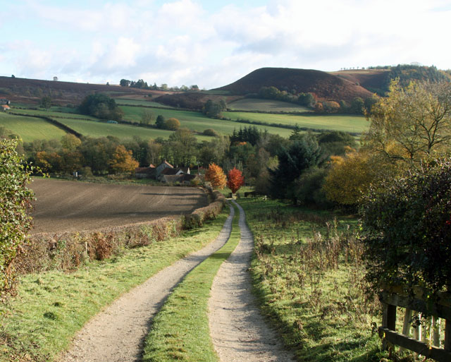
Broom Hill and The Nab
The track slopes down the side of Broom Hill towards the farm (shown simply as "Mill" on OS maps). The fine soil looks well drained and capable of producing a crop, unlike the pastures on the east side of the valley which were very wet and claggy.
"The Nab" is the rounded hill on the skyline.
"The Nab" is the rounded hill on the skyline.
 Map © Crown Copyright")
TIP: Click the map for more Large scale mapping
- Grid Square
- SE6890, 143 images (more nearby 🔍)
- Photographer
- Christine Church (more nearby)
- Contributed by
- Peter Church (more nearby)
- Date Taken
- Monday, 29 October, 2012 (more nearby)
- Submitted
- Tuesday, 30 October, 2012
- Subject Location
-
OSGB36:
 SE 6859 9039 [10m precision]
WGS84: 54:18.2711N 0:56.8454W - Camera Location
-
OSGB36: SE 6839 9038
- View Direction
- EAST (about 90 degrees)