2012
NA7246 : Flannan Isles: old shieling
taken 12 years ago, near to Dearc na Sgeir [other Features], Na h-Eileanan an Iar, Great Britain
Flannan Isles: old shieling
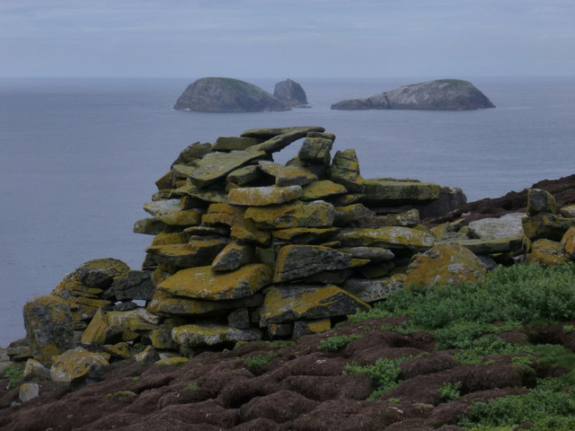
The more distinct of two drystone structures on the western side of Eilean Mòr, the main Flannan isle, marked as Old Shielings on the large-scale map. These were essentially huts for shelter, occupied seasonally by those tending to animals on the uplands of Scotland. Quite to what extent this would have occurred on Flannan, I don't know - I am led to understand that they fell into disuse certainly by the end of the 18th century.
The westernmost Flannan Islands, chiefly Roaiream and a couple of neighbours, are a couple of miles in the distance.
The westernmost Flannan Islands, chiefly Roaiream and a couple of neighbours, are a couple of miles in the distance.
 Map © Crown Copyright")
TIP: Click the map for more Large scale mapping
- Grid Square
- NA7246, 70 images (more nearby 🔍)
- Photographer
- Chris Downer (more nearby)
- Date Taken
- Saturday, 18 August, 2012 (more nearby)
- Submitted
- Tuesday, 30 October, 2012
- Subject Location
-
OSGB36:
 NA 7230 4689 [10m precision]
WGS84: 58:17.2767N 7:35.6656W - Camera Location
-
OSGB36: NA 7232 4689
- View Direction
- WEST (about 270 degrees)