2012
J1953 : Central reservation gaps, Dromore bypass
taken 11 years ago, near to Dromore, Co Down, Northern Ireland
Central reservation gaps, Dromore bypass
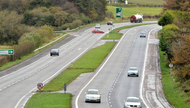
Central reservation gaps, on the Dromore bypass, looking towards Sprucefield and Belfast. The two nearest the camera serve Maypole Hill J2053 : Up the Maypole Hill. The third allows traffic from the Connellystown Road (from which the red car has come) to turn right towards Banbridge and Newry. The view is from this flyover J1953 : Flyover, Dromore bypass which has a plate reading 1972.
Central reservation gaps, Sprucefield - Loughbrickland
The Sprucefield Loughbrickland section of the Belfast Newry/Dublin road was built, in the 1970s, as an all-purpose dual carriageway allowing right and U turns. The high number of minor side roads in Co Down and various private accesses means that there are frequent gaps in the central reservation. The road has been improved with flyovers and underpasses but numerous gaps remain. There are long-term plans to close some and build more grade-separated junctions.
Loading map... (JavaScript required)
- Grid Square
- J1953, 86 images (more nearby 🔍)
- Photographer
- Albert Bridge (more nearby)
- Date Taken
- Friday, 2 November, 2012 (more nearby)
- Submitted
- Friday, 2 November, 2012
- Subject Location
-
Irish:
 J 196 535 [100m precision]
WGS84: 54:24.9657N 6:9.4605W - Camera Location
-
Irish: J 194 533
- View Direction
- Northeast (about 45 degrees)