2003
TQ1308 : Cissbury Ring
taken 21 years ago, near to Findon, West Sussex, England
This is 1 of 4 images, with title Cissbury Ring in this square
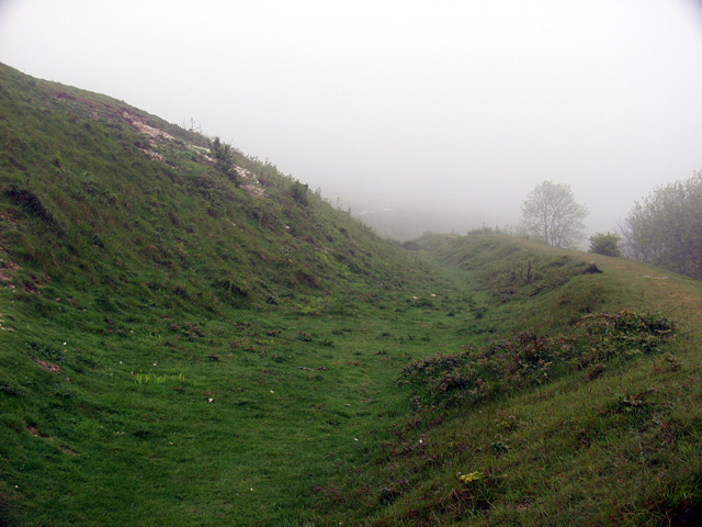
Cissbury Ring
Part of the earthworks for this huge Iron Age Hillfort. This section is in the NW quadrant of the fort, in deep fog!
 Map © Crown Copyright")
TIP: Click the map for more Large scale mapping
- Grid Square
- TQ1308, 63 images (more nearby 🔍)
- Photographer
- Alan Simkins (more nearby)
- Date Taken
- Saturday, 17 May, 2003 (more nearby)
- Submitted
- Wednesday, 13 April, 2005
- Subject Location
-
OSGB36:
 TQ 13 08 [1000m precision]
WGS84: 50:51.8925N 0:23.3126W