2012
SE0317 : The site of St Matthews Church, Rishworth
taken 11 years ago, near to Booth Wood, Calderdale, England
The site of St Matthews Church, Rishworth
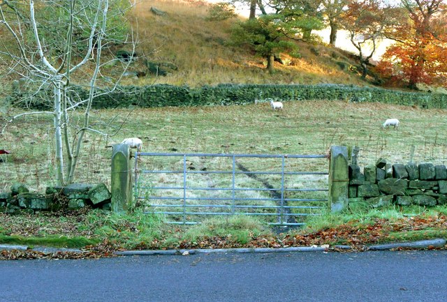
The church was popularly known as The Iron Church, The Tin Tabernacle, and The Tin Tab because it was constructed with galvanised iron sheets on a wooden frame. It was built in 1890 when the facilities at what became Rishworth School Chapel were inadequate. The church became redundant and closed in 1927 when Saint John's Church, Godly Lane was built. (Malcolm Bull) The church foundations have gone without trace, but the gateposts still remain.
 Map © Crown Copyright")
TIP: Click the map for more Large scale mapping
- Grid Square
- SE0317, 71 images (more nearby 🔍)
- Photographer
- Humphrey Bolton (more nearby)
- Date Taken
- Monday, 5 November, 2012 (more nearby)
- Submitted
- Wednesday, 7 November, 2012
- Subject Location
-
OSGB36:
 SE 0347 1707 [10m precision]
WGS84: 53:39.0073N 1:56.9387W - Camera Location
-
OSGB36: SE 0347 1707
- View Direction
- East-southeast (about 112 degrees)