2012
NN9357 : Rob Roy Way marker
taken 11 years ago, near to Pitlochry, Perth And Kinross, Scotland
Rob Roy Way marker
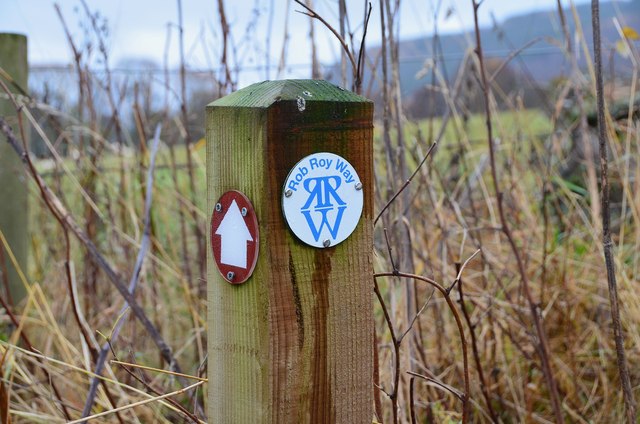
A marker post on the Clunie path from Pitlochry into the woodlands on Carra Beag.
The Rob Roy Way is a long distance walking route between Drymen and Pitlochry, a distance of 77 miles (123 km) via Aberfoyle, Callander, Strathyre, Killin and Aberfeldy. There is a longer option of 94 miles (150 km) via Amulree in Glen Quaich.
The Rob Roy Way is a long distance walking route between Drymen and Pitlochry, a distance of 77 miles (123 km) via Aberfoyle, Callander, Strathyre, Killin and Aberfeldy. There is a longer option of 94 miles (150 km) via Amulree in Glen Quaich.
 Map © Crown Copyright")
TIP: Click the map for more Large scale mapping
- Grid Square
- NN9357, 233 images (more nearby 🔍)
- Photographer
- Jim Barton (more nearby)
- Date Taken
- Saturday, 10 November, 2012 (more nearby)
- Submitted
- Monday, 12 November, 2012
- Subject Location
-
OSGB36:
 NN 9386 5708 [10m precision]
WGS84: 56:41.6008N 3:44.0795W - Camera Location
-
OSGB36: NN 9386 5708
- View Direction
- Southeast (about 135 degrees)