2012
NZ2464 : Benchmark on St James Park Barrack Road wall
taken 12 years ago, near to Newcastle Upon Tyne, England
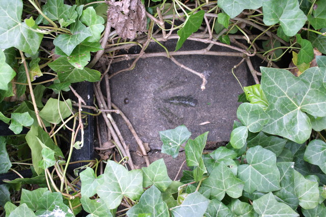
Benchmark on St James Park Barrack Road wall
Ordnance Survey rivet benchmark described on the Bench Mark Database at Link
 Map © Crown Copyright")
TIP: Click the map for more Large scale mapping
- Grid Square
- NZ2464, 2467 images (more nearby 🔍)
- Photographer
- Roger Templeman (more nearby)
- Date Taken
- Monday, 21 May, 2012 (more nearby)
- Submitted
- Monday, 19 November, 2012
- Subject Location
-
OSGB36:
 NZ 2413 6458 [10m precision]
WGS84: 54:58.5151N 1:37.4734W - Camera Location
-
OSGB36: NZ 2413 6458
- View Direction
- East-southeast (about 112 degrees)