2012
NY3330 : The rim of Bannerdale
taken 12 years ago, 3 km from Mungrisdale, Cumbria, England
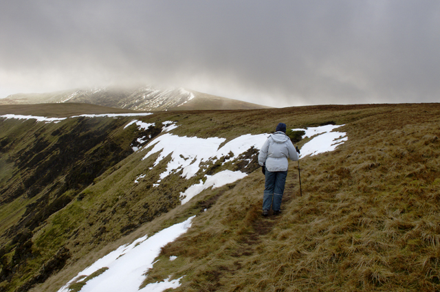
The rim of Bannerdale
This tiny path clings to the edge of Bannerdale round the head of the dale
 Map © Crown Copyright")
TIP: Click the map for more Large scale mapping
- Grid Square
- NY3330, 45 images (more nearby 🔍)
- Photographer
- Tom Richardson (more nearby)
- Date Taken
- Monday, 23 January, 2012 (more nearby)
- Submitted
- Tuesday, 20 November, 2012
- Subject Location
-
OSGB36:
 NY 3329 3003 [10m precision]
WGS84: 54:39.6553N 3:2.1396W - Camera Location
-
OSGB36: NY 3333 3010
- View Direction
- South-southwest (about 202 degrees)