2012
SK5451 : Papplewick, NG15
taken 11 years ago, near to Papplewick, Nottinghamshire, England
This is 1 of 12 images, with title Papplewick, NG15 in this square
Papplewick, NG15
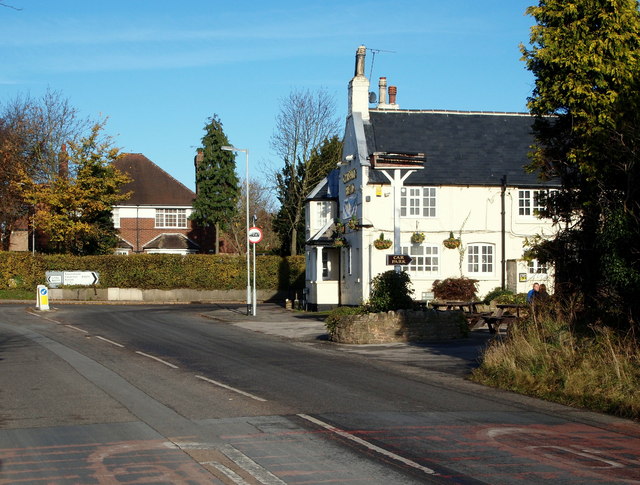
The Griffin's Head pub is seen here at the crossroads with the B6011, with the majority of Moor Road (the B683 road) behind the photographer. The road stretches back for several miles behind the photographer forming a T junction with the A611 (Nottingham-Hucknall) Road. The pub is Grade II-listed, having been built during the 18-19th century. The Griffin's head symbol may have stemmed from this creature's appearance on the family crest of the Montagu's of Papplewick Hall, one of whom was Charles Montagu the M.P., who died in 1759.
 Map © Crown Copyright")
TIP: Click the map for more Large scale mapping
- Grid Square
- SK5451, 95 images (more nearby 🔍)
- Photographer
- David Hallam-Jones (more nearby)
- Date Taken
- Saturday, 17 November, 2012 (more nearby)
- Submitted
- Wednesday, 21 November, 2012
- Subject Location
-
OSGB36:
 SK 5488 5105 [10m precision]
WGS84: 53:3.2338N 1:10.9614W - Camera Location
-
OSGB36: SK 5486 5102
- View Direction
- North-northeast (about 22 degrees)