2012
SH5948 : Nameboard, St Mary's Church, Beddgelert
taken 12 years ago, near to Beddgelert, Gwynedd, Wales
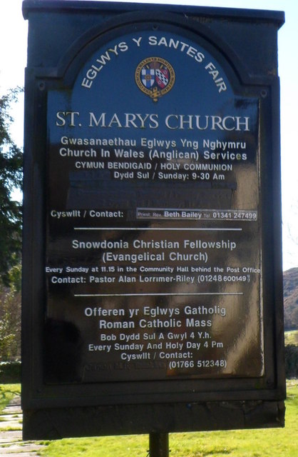
Nameboard, St Mary's Church, Beddgelert
The board shows that the Anglican church Link is also used for services by other denominations.
 Map © Crown Copyright")
TIP: Click the map for more Large scale mapping
- Grid Square
- SH5948, 369 images (more nearby 🔍)
- Photographer
- Jaggery (more nearby)
- Date Taken
- Monday, 26 March, 2012 (more nearby)
- Submitted
- Saturday, 24 November, 2012
- Subject Location
-
OSGB36:
 SH 5904 4805 [10m precision]
WGS84: 53:0.6687N 4:6.1487W - Camera Location
-
OSGB36: SH 5904 4805
- View Direction
- South-southeast (about 157 degrees)