2012
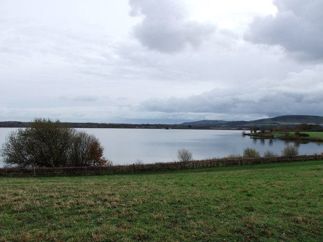
TQ5207 : Arlington Reservoir
taken 11 years ago, near to Arlington, East Sussex, England
This is 1 of 12 images, with title Arlington Reservoir in this square
Arlington Reservoir
Arlington Reservoir is a 99.4 (245.6 acre) biological Site of Special Scientific Interest in Arlington, East Sussex. The site was notified in 1985 under the Wildlife and Countryside Act 1981. The site is also of ornithological interest, with over 1% of the wintering wigeon being populated within the site. Alder Alnus glutinosa and willow Salix species are part of the open water. The site is also home to a scrub of Crataegus monogyna. A large jetty juts into the water and a few hundred yards away there is a water treatment building. The reservoir was originally created by damming the River Cuckmere, which previously meandered to the middle of the present-day reservoir. The Cuckmere is now channelled in a straight line just to the east.
Extract from wikipedia Link
See other images of Arlington Reservoir
Extract from wikipedia Link
See other images of Arlington Reservoir
 Map © Crown Copyright")
TIP: Click the map for more Large scale mapping
- Grid Square
- TQ5207, 75 images (more nearby 🔍)
- Photographer
- PAUL FARMER (more nearby)
- Date Taken
- Friday, 23 November, 2012 (more nearby)
- Submitted
- Saturday, 24 November, 2012
- Subject Location
-
OSGB36:
 TQ 5297 0740 [10m precision]
WGS84: 50:50.7543N 0:10.2892E - Camera Location
-
OSGB36: TQ 5292 0741
- View Direction
- East-southeast (about 112 degrees)