2012
TA0225 : Hessle Foreshore
taken 11 years ago, near to Hessle, East Riding of Yorkshire, England
This is 1 of 6 images, with title Hessle Foreshore in this square
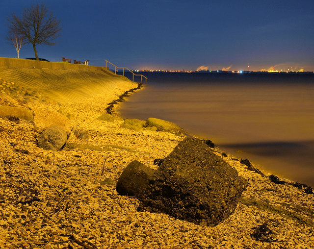
Hessle Foreshore
The foreshore is just a few metres east of the north tower of the Humber Bridge looking down river. The river itself in the photo appears quite undefined as the photo was of about 10 seconds exposure and has blurred it as it flows.
 Map © Crown Copyright")
TIP: Click the map for more Large scale mapping
- Grid Square
- TA0225, 634 images (more nearby 🔍)
- Photographer
- Andy Beecroft (more nearby)
- Date Taken
- Friday, 30 November, 2012 (more nearby)
- Submitted
- Saturday, 1 December, 2012
- Subject Location
-
OSGB36:
 TA 0254 2528 [10m precision]
WGS84: 53:42.8324N 0:26.8673W - Camera Location
-
OSGB36: TA 0243 2529
- View Direction
- EAST (about 90 degrees)