2012
NY7486 : Donkley Wood
taken 11 years ago, near to Falstone, Northumberland, England
Donkley Wood
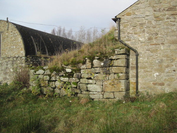
The ruins of a bastle stand amongst the farm buildings at Donkleywood. Records from the 1950s show the building then stood up to 4.5m high. The walls are very thick, measuring between 1.5 and 1.7m. The east end of the building now stands nearly 3m high. However, the west end of the bastle has been built over but parts of the west wall, such as the gable end, can still be seen inside the new building.
Link (Archive Link )
Link
 Map © Crown Copyright")
TIP: Click the map for more Large scale mapping
- Grid Square
- NY7486, 14 images (more nearby 🔍)
- Photographer
- Les Hull (more nearby)
- Date Taken
- Wednesday, 28 November, 2012 (more nearby)
- Submitted
- Saturday, 15 December, 2012
- Subject Location
-
OSGB36:
 NY 7461 8639 [10m precision]
WGS84: 55:10.2696N 2:24.0085W - Camera Location
-
OSGB36: NY 7461 8636
- View Direction
- NORTH (about 0 degrees)