2012
NM9525 : Beinn Ghlas
taken 12 years ago, 4 km NNE of Musdale, Argyll And Bute, Scotland
This is 1 of 3 images, with title Beinn Ghlas in this square
Beinn Ghlas
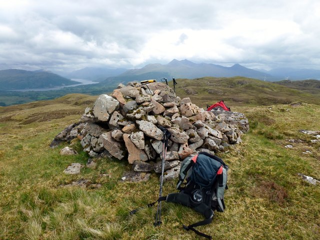
Large ancient cairn at obvious summit with Jim Bloomer on dry clear day with high cloud and another lovely view of Ben Cruachan.
Name: Beinn Ghlas
Hill number: 1386
Height: 512m / 1680ft
Area: 19A: Oban to Loch Fyne
Class: Ma,5H
Grid ref: NM 95750 25958
Summit feature: cairn
Drop: 265m
Col: 247m NM947233
Name: Beinn Ghlas
Hill number: 1386
Height: 512m / 1680ft
Area: 19A: Oban to Loch Fyne
Class: Ma,5H
Grid ref: NM 95750 25958
Summit feature: cairn
Drop: 265m
Col: 247m NM947233
 Map © Crown Copyright")
TIP: Click the map for more Large scale mapping
- Grid Square
- NM9525, 8 images (more nearby 🔍)
- Photographer
- Rude Health (more nearby)
- Date Taken
- Friday, 8 June, 2012 (more nearby)
- Submitted
- Sunday, 16 December, 2012
- Subject Location
-
OSGB36:
 NM 9565 2592 [10m precision]
WGS84: 56:22.8758N 5:18.6836W - Camera Location
-
OSGB36: NM 9564 2591
- View Direction
- East-northeast (about 67 degrees)