2012
ST9051 : White Horse Hill, Westbury
taken 12 years ago, near to Bratton, Wiltshire, England
White Horse Hill, Westbury
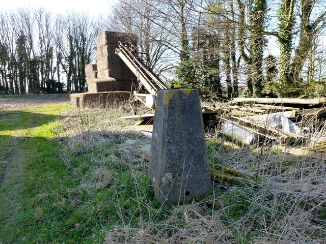
Trig looking lonely in the White Horse Farm yard with limited views on this very popular hill.
Name: White Horse Hill
Hill number: 5425
Height: 230m / 755ft
Area: 41: South Central England
Class: Hu
Grid ref: ST 90114 51141
Summit feature: trig point: OS measurement
Drop: 108m
Col: 122m ST858478
Name: White Horse Hill
Hill number: 5425
Height: 230m / 755ft
Area: 41: South Central England
Class: Hu
Grid ref: ST 90114 51141
Summit feature: trig point: OS measurement
Drop: 108m
Col: 122m ST858478
 Map © Crown Copyright")
TIP: Click the map for more Large scale mapping
- Grid Square
- ST9051, 41 images (more nearby 🔍)
- Photographer
- Rude Health (more nearby)
- Date Taken
- Saturday, 10 March, 2012 (more nearby)
- Submitted
- Sunday, 30 December, 2012
- Subject Location
-
OSGB36:
 ST 9010 5112 [10m precision]
WGS84: 51:15.5492N 2:8.5955W - Camera Location
-
OSGB36: ST 9012 5112
- View Direction
- West-northwest (about 292 degrees)