2011
NG0089 : Greabhal Summit
taken 13 years ago, near to Northton, Isle of Lewis And Harris, Na h-Eileanan an Iar, Scotland
This is 1 of 2 images, with title Greabhal Summit in this square
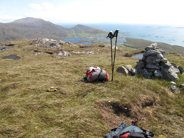
Greabhal Summit
Parked at the Seallum Centre then climbed steeply up to ridge then along to larger westerly cairn with Jim Bloomer and Mat Webster. Looking SE towards Roineabhal and Sranndabhal.
Name: Greabhal
Hill number: 1605
Height: 280m / 919ft
Area: 24B: Harris and Nearby Islands
Class: Ma
Grid ref: NG 00386 89161
Summit feature: ground 2m NE of cairn
Drop: 194m
Col: 86m NG002907
Name: Greabhal
Hill number: 1605
Height: 280m / 919ft
Area: 24B: Harris and Nearby Islands
Class: Ma
Grid ref: NG 00386 89161
Summit feature: ground 2m NE of cairn
Drop: 194m
Col: 86m NG002907
 Map © Crown Copyright")
TIP: Click the map for more Large scale mapping
- Grid Square
- NG0089, 6 images (more nearby 🔍)
- Photographer
- Rude Health (more nearby)
- Date Taken
- Friday, 10 June, 2011 (more nearby)
- Submitted
- Monday, 31 December, 2012
- Subject Location
-
OSGB36:
 NG 003 891 [100m precision]
WGS84: 57:47.4945N 7:2.6608W - Camera Location
-
OSGB36: NG 003 891
- View Direction
- Southeast (about 135 degrees)