2012
NY6001 : Ruined iron barn, lower Borrowdale
taken 11 years ago, 3 km from Tebay, Cumbria, England
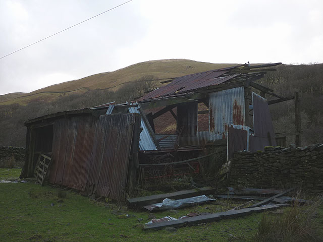
Ruined iron barn, lower Borrowdale
Surely with the high price of scrap iron someone can remove this roadside eyesore in a lovely location?
 Map © Crown Copyright")
TIP: Click the map for more Large scale mapping
- Grid Square
- NY6001, 54 images (more nearby 🔍)
- Photographer
- Karl and Ali (more nearby)
- Date Taken
- Sunday, 30 December, 2012 (more nearby)
- Submitted
- Tuesday, 1 January, 2013
- Subject Location
-
OSGB36:
 NY 6018 0162 [10m precision]
WGS84: 54:24.5080N 2:36.8996W - Camera Location
-
OSGB36: NY 6019 0161
- View Direction
- Northwest (about 315 degrees)