2013
SD9820 : Boundary stone, Turvin Clough
taken 11 years ago, 4 km E of Warland, Calderdale, England
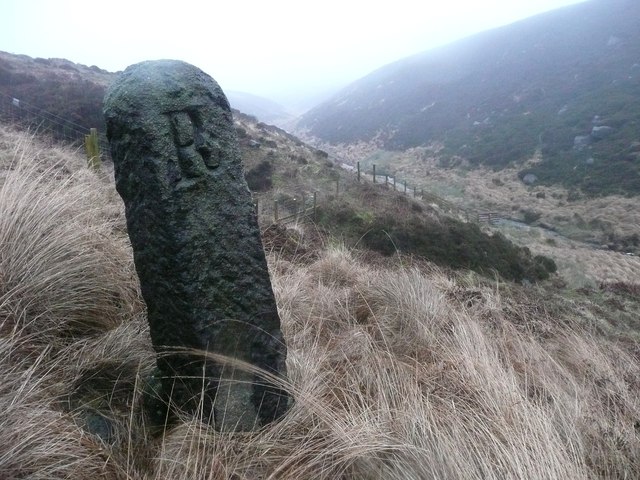
Boundary stone, Turvin Clough
This was not really a suitable day for hunting boundary stones, but this image of a tall stone on the boundary between Langfield and the Turley Holes Moss division of Sowerby (later Erringden) clearly shows an inscribed 'R'. There is an 'L' on the other side, facing Langfield territory. Why 'R'? It is perhaps the initial of the landowner's surname.
 Map © Crown Copyright")
TIP: Click the map for more Large scale mapping
- Grid Square
- SD9820, 36 images (more nearby 🔍)
- Photographer
- Humphrey Bolton (more nearby)
- Date Taken
- Thursday, 3 January, 2013 (more nearby)
- Submitted
- Thursday, 3 January, 2013
- Subject Location
-
OSGB36:
 SD 9811 2020 [10m precision]
WGS84: 53:40.6957N 2:1.8053W - Camera Location
-
OSGB36: SD 9811 2020
- View Direction
- East-northeast (about 67 degrees)