2012

NZ8909 : Path junction near Whitby

taken 11 years ago, near to Whitby, North Yorkshire, England
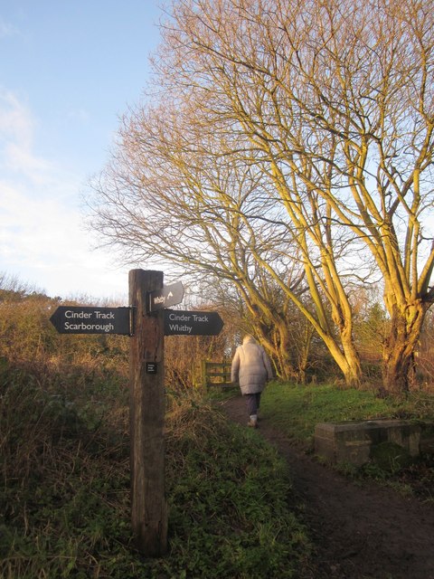
Path junction near Whitby
Taken from the path crossing shown just five days earlier in NZ8909 : Footpath crossing the railway path at the site of Monkey Bridge. What must be one of the bridge abutments referred to by Humphrey can be seen on the right. The Cinder Track follows the former railway line from Scarborough to Whitby. The walker is following the Esk Valley Walk along footpath 30 23/28/2, and
is about to cross another dismantled railway line.

Creative Commons Licence [Some Rights Reserved]   © Copyright Derek Harper and licensed for reuse under this Creative Commons Licence.
Geographical Context: Lowlands Paths Railways Long Distance Path: Esk Valley Walk Cinder Track other tags: Footpath Signpost Trees Bridge Abutment Public Footpath Click a tag, to view other nearby images.
1:50,000 Modern Day Landranger(TM) Map © Crown Copyright
+
1:50,000 Modern Day Landranger(TM) Map © Crown Copyright
TIP: Click the map for more Large scale mapping
Grid Square
NZ8909, 323 images   (more nearby 🔍)
Photographer
Derek Harper   (more nearby)
Date Taken
Sunday, 30 December, 2012   (more nearby)
Submitted
Friday, 11 January, 2013
Subject Location
OSGB36: geotagged! NZ 8950 0992 [10m precision]
WGS84: 54:28.6053N 0:37.2179W
Camera Location
OSGB36: geotagged! NZ 8950 0992
View Direction
West-southwest (about 247 degrees)
Clickable map
+
NW N NE
W Go E
SW S SE
Image classification(about): Geograph
This page has been viewed about 73 times
You are not logged in login | register