2011
SN8121 : Bannau Sir Gaer - Picws Du
taken 13 years ago, 4 km SE of Llanddeusant, Carmarthenshire/Sir Gaerfyrddin, Wales
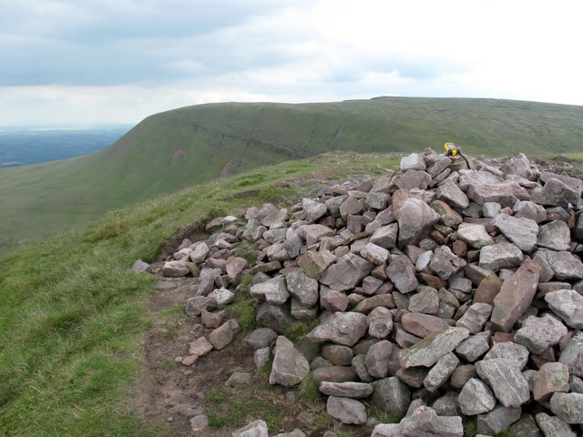
Bannau Sir Gaer - Picws Du
Nuttall's walk 13.6. on lovely summers day.
Name: Bannau Sir Gaer - Picws Du
Hill number: 2236
Height: 749m / 2457ft
Area: 32A: Llandovery to Monmouth
Class: Hew,N,sHu
Grid ref: SN 81174 21864
Summit feature: cairn
Drop: 93m
Col: 656m SN816217
Name: Bannau Sir Gaer - Picws Du
Hill number: 2236
Height: 749m / 2457ft
Area: 32A: Llandovery to Monmouth
Class: Hew,N,sHu
Grid ref: SN 81174 21864
Summit feature: cairn
Drop: 93m
Col: 656m SN816217
 Map © Crown Copyright")
TIP: Click the map for more Large scale mapping
- Grid Square
- SN8121, 51 images (more nearby 🔍)
- Photographer
- Rude Health (more nearby)
- Date Taken
- Saturday, 2 July, 2011 (more nearby)
- Submitted
- Wednesday, 16 January, 2013
- Subject Location
-
OSGB36:
 SN 8120 2184 [10m precision]
WGS84: 51:52.9456N 3:43.6442W - Camera Location
-
OSGB36: SN 8118 2183
- View Direction
- East-northeast (about 67 degrees)