2012
NZ8910 : Bridge over Cinder Track
taken 11 years ago, near to Whitby, North Yorkshire, England
This is 1 of 6 images, with title starting with Bridge in this square
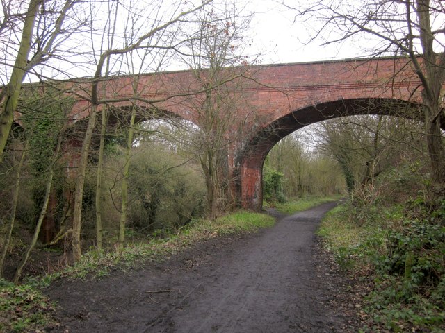
Bridge over Cinder Track
This fine brick viaduct crosses the lines of two former railways, including the former Scarborough and Whitby line (NCN1). It now seems to carry just a path.
Old Scarborough to Whitby line
The railway line between Scarborough and Whitby was opened in 1885 and was very popular with holiday makers. It opened up the North Yorkshire coastline to tourists. It was closed in 1965. The route now is a cinder track and forms part of National cycleway 1 (Dover to John O' Groats). It is also a popular walking trail. A full history of the line can be read at Link

 Map © Crown Copyright")
TIP: Click the map for more Large scale mapping
- Grid Square
- NZ8910, 700 images (more nearby 🔍)
- Photographer
- Derek Harper (more nearby)
- Date Taken
- Monday, 31 December, 2012 (more nearby)
- Submitted
- Thursday, 17 January, 2013
- Subject Location
-
OSGB36:
 NZ 8941 1005 [10m precision]
WGS84: 54:28.6763N 0:37.2988W - Camera Location
-
OSGB36: NZ 8942 1003
- View Direction
- North-northwest (about 337 degrees)