TL5394 : Winter sun and The River Delph - The Ouse Washes near Welney
taken 11 years ago, near to Welney, Norfolk, England
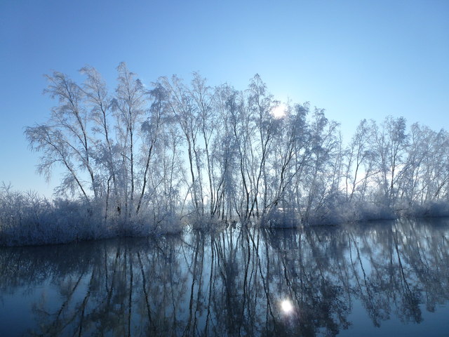
The Ouse Washes, also known as The Hundred Foot Washes, is an area of grassland (washland) that can be deliberately flooded lying between the Old and New Bedford Rivers. These rivers are derived from the River Great Ouse, a major tributary of East Anglia's Wash. They were dug in the 16th & 17th centuries as part of a programme to drain The Fens of floodwater for agriculture. In 1630, King Charles I granted a drainage charter to the 4th Earl of Bedford who engaged the Dutch engineer Cornelius Vermuyden to construct the two Bedford rivers. The purpose of the new rivers was to facilitate drainage of the River Great Ouse between Earith and Downham Market.
The New Bedford River flows through the entire length of the washland and The River Delph flows through the washes either side of Welney. The flood waters are contained between 2 parallel embankments - The Old Bedford Barrier Bank and the Hundred Foot Bank - and the area between the banks is approximately 20 miles long and half a mile wide in places. It is permanent grassland and used for livestock grazing when not flooded and acts as washland or flood reservoir allowing the flow of water to the sea to be contained and released in a controlled way during the winter and occasionally in summer.
Please visit Linkfor more information.
 Map © Crown Copyright")
- Grid Square
- TL5394, 5 images (more nearby 🔍)
- Photographer
- Richard Humphrey (more nearby)
- Date Taken
- Thursday, 17 January, 2013 (more nearby)
- Submitted
- Saturday, 19 January, 2013
- Subject Location
-
OSGB36:
 TL 5323 9411 [10m precision]
WGS84: 52:31.3994N 0:15.4268E - Camera Location
-
OSGB36: TL 5320 9414
- View Direction
- Southeast (about 135 degrees)