2013
NS8398 : Ford on the Loss Burn
taken 11 years ago, near to Blairlogie, Stirling, Scotland
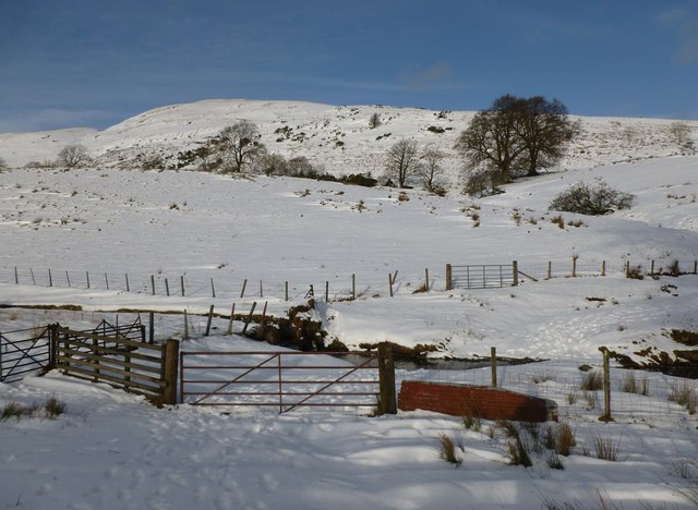
Ford on the Loss Burn
The old farm road to Jerah from the Sheriffmuir road crosses the burn here. Loss Hill is in the background behind the trees.
 Map © Crown Copyright")
TIP: Click the map for more Large scale mapping
- Grid Square
- NS8398, 17 images (more nearby 🔍)
- Photographer
- Alan O'Dowd (more nearby)
- Date Taken
- Saturday, 26 January, 2013 (more nearby)
- Submitted
- Monday, 28 January, 2013
- Subject Location
-
OSGB36:
 NS 8344 9898 [10m precision]
WGS84: 56:10.1505N 3:52.7268W - Camera Location
-
OSGB36: NS 8343 9896
- View Direction
- North-northeast (about 22 degrees)