2013
TA0828 : Park Street, Kingston upon Hull
taken 11 years ago, near to Kingston Upon Hull, England
This is 1 of 14 images, with title Park Street, Kingston upon Hull in this square
Park Street, Kingston upon Hull
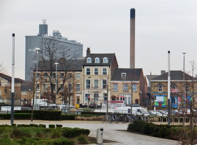
Former houses, nos.23-28, on the west side of the street, between the bridge over the railway and Londesborough Street. In the background, left, the multi-storey Hull Royal Infirmary, Anlaby Road. Photo taken from landscaped forecourt of Tesco store.
TA0829 : Park Street, Kingston upon Hull
TA0829 : Park Street, Kingston upon Hull
 Map © Crown Copyright")
TIP: Click the map for more Large scale mapping
- Grid Square
- TA0828, 889 images (more nearby 🔍)
- Photographer
- Bernard Sharp (more nearby)
- Date Taken
- Tuesday, 8 January, 2013 (more nearby)
- Submitted
- Thursday, 31 January, 2013
- Subject Location
-
OSGB36:
 TA 0875 2895 [10m precision]
WGS84: 53:44.7354N 0:21.1469W - Camera Location
-
OSGB36: TA 0889 2899
- View Direction
- West-southwest (about 247 degrees)