2013
SD1998 : Sunlight on Silver How
taken 11 years ago, 3 km from Beckfoot, Cumbria, England
Sunlight on Silver How
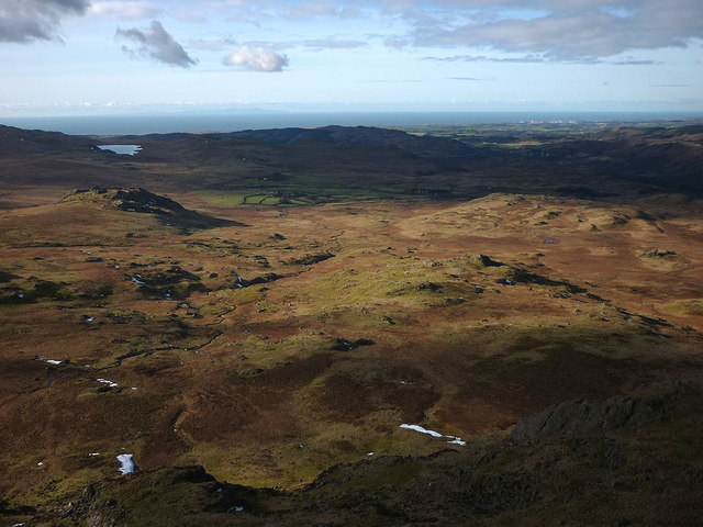
Sunlight picks out the outcrops on the large expanse of moorland below Green Crag. On the left is the lump of Great Crag with Devoke Water immediately above it. Beyond is the Irish Sea with the Isle of Man visible on the horizon and (unfortunately) Sellafield nuclear waste reprocessing plant on the right. At least the cooling towers of Calder Hall have now disappeared.
 Map © Crown Copyright")
TIP: Click the map for more Large scale mapping
- Grid Square
- SD1998, 17 images (more nearby 🔍)
- Photographer
- Karl and Ali (more nearby)
- Date Taken
- Saturday, 2 February, 2013 (more nearby)
- Submitted
- Sunday, 3 February, 2013
- Subject Location
-
OSGB36:
 SD 1927 9836 [10m precision]
WGS84: 54:22.4593N 3:14.6558W - Camera Location
-
OSGB36: SD 1998 9822
- View Direction
- WEST (about 270 degrees)