2013
NO4573 : Road on Black Hill
taken 11 years ago, near to Smithy Burn [water Feature], Angus, Great Britain
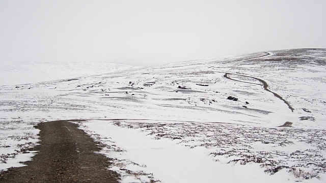
Road on Black Hill
At the moment the road is not used as much as the ditch beside it. The ditch is full of old snow and makes an alternative road for the estate's preferred track laying vehicles.
Some thought has gone into this road. It is raised so does not collect snow, and the wide ditch is obviously a deliberate tactic for the track layers. Upland roads in Scotland are often crudely bulldozed with little engineering thought, this is quite different.
Some thought has gone into this road. It is raised so does not collect snow, and the wide ditch is obviously a deliberate tactic for the track layers. Upland roads in Scotland are often crudely bulldozed with little engineering thought, this is quite different.
 Map © Crown Copyright")
TIP: Click the map for more Large scale mapping
- Grid Square
- NO4573, 5 images (more nearby 🔍)
- Photographer
- Richard Webb (more nearby)
- Date Taken
- Saturday, 9 February, 2013 (more nearby)
- Submitted
- Sunday, 10 February, 2013
- Subject Location
-
OSGB36:
 NO 4592 7383 [10m precision]
WGS84: 56:51.1644N 2:53.3008W - Camera Location
-
OSGB36: NO 4599 7353
- View Direction
- North-northwest (about 337 degrees)