2010
SH8379 : Bryn Euryn
taken 14 years ago, near to Llandrillo-yn-Rhôs, Conwy, Wales
This is 1 of 2 images, with title starting with Bryn in this square
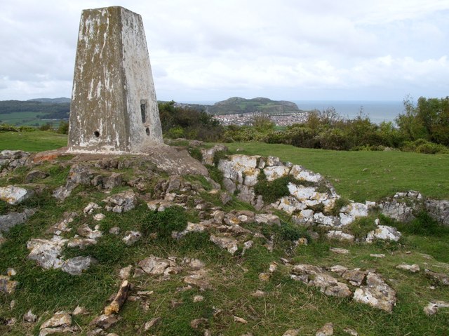
Bryn Euryn
Climbed from nature reserve car park close to Ship Pub, then followed the green way market summit trail. Good views of Great Orme for a grey mild Friday.
Name: Bryn Euryn
Hill number: 5169
Height: 131m / 430ft
Area: 30C: Llandudno to Wrexham
Class: Hu
Grid ref: SH 83221 79846
Summit feature: trig point: OS measurement
Drop: 119m
Col: 12m SH833794
Name: Bryn Euryn
Hill number: 5169
Height: 131m / 430ft
Area: 30C: Llandudno to Wrexham
Class: Hu
Grid ref: SH 83221 79846
Summit feature: trig point: OS measurement
Drop: 119m
Col: 12m SH833794
 Map © Crown Copyright")
TIP: Click the map for more Large scale mapping
- Grid Square
- SH8379, 64 images (more nearby 🔍)
- Photographer
- Rude Health (more nearby)
- Date Taken
- Friday, 15 October, 2010 (more nearby)
- Submitted
- Monday, 11 February, 2013
- Subject Location
-
OSGB36:
 SH 8322 7985 [10m precision]
WGS84: 53:18.1611N 3:45.2331W - Camera Location
-
OSGB36: SH 8323 7984
- View Direction
- West-northwest (about 292 degrees)