2013
SX8866 : Site of new road, Edginswell
taken 11 years ago, near to Shiphay, Torbay, England
This is 1 of 15 images, with title Site of new road, Edginswell in this square
Site of new road, Edginswell
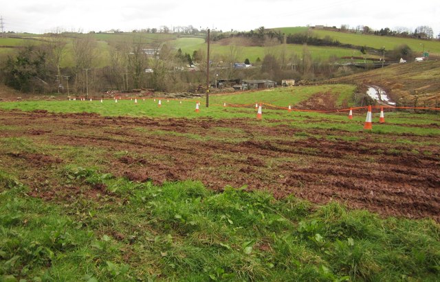
Taken from the same spot as SX8866 : Site of new road, Edginswell. The cones seem to indicate the edge of the curving embankment that will carry a slip road from Hamelin Way onto the new Kingskerswell bypass. Down in the dip is a timber yard which lies directly in the path of the new road.
Across the Edginswell Stream and the railway in the background, traffic can be seen on the A380 at Kerswell Gardens where it meets Hamelin Way.
Across the Edginswell Stream and the railway in the background, traffic can be seen on the A380 at Kerswell Gardens where it meets Hamelin Way.
 Map © Crown Copyright")
TIP: Click the map for more Large scale mapping
- Grid Square
- SX8866, 288 images (more nearby 🔍)
- Photographer
- Derek Harper (more nearby)
- Date Taken
- Thursday, 14 February, 2013 (more nearby)
- Submitted
- Thursday, 21 February, 2013
- Subject Location
-
OSGB36:
 SX 8861 6635 [10m precision]
WGS84: 50:29.1805N 3:34.2909W - Camera Location
-
OSGB36: SX 8855 6632
- View Direction
- East-northeast (about 67 degrees)