2013
SX8770 : Work on St Marychurch Road
taken 11 years ago, near to Netherton, Devon, England
This is 1 of 2 images, with title Work on St Marychurch Road in this square
Work on St Marychurch Road
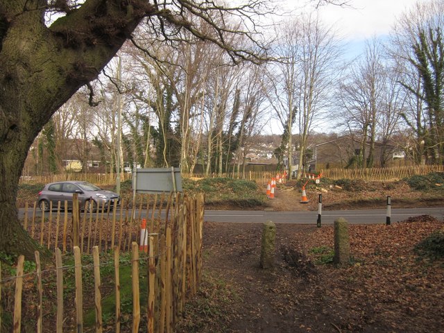
Trees have been cleared, mainly on the west side of St Marychurch Road, in preparation for changes at the junction with Aller Brake Road. A vehicular link will be created, but only for traffic heading to and from Penn Inn. (This is a consequence of the new Kingkerswell bypass; traffic will no longer be able to turn right at the bottom of Aller Brake Road).
The venerable oak tree to the left of the camera, shown in SX8770 : Tree by St Marychurch Road, will survive - at least, that's the intention. Cones and tape indicate the footpath across the cleared area to and from Belgrave Road.
The venerable oak tree to the left of the camera, shown in SX8770 : Tree by St Marychurch Road, will survive - at least, that's the intention. Cones and tape indicate the footpath across the cleared area to and from Belgrave Road.
 Map © Crown Copyright")
TIP: Click the map for more Large scale mapping
- Grid Square
- SX8770, 185 images (more nearby 🔍)
- Photographer
- Derek Harper (more nearby)
- Date Taken
- Saturday, 16 February, 2013 (more nearby)
- Submitted
- Thursday, 21 February, 2013
- Subject Location
-
OSGB36:
 SX 8797 7021 [10m precision]
WGS84: 50:31.2551N 3:34.9015W - Camera Location
-
OSGB36: SX 8796 7020
- View Direction
- Northeast (about 45 degrees)