2013
TR1457 : Derelict site, 7-16 Stour Street
taken 11 years ago, near to Canterbury, Kent, England
This is 1 of 5 images, with title starting with Derelict in this square
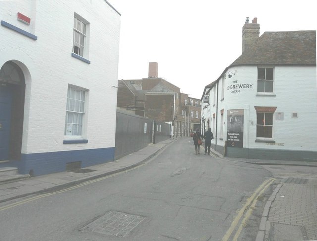
Derelict site, 7-16 Stour Street
The site is just beyond the white-painted house on the left. Planning permission has been granted by Canterbury City Council under application numbers CA//11/00509 for the demolition of existing former warehouse and erection of 12 almshouse flats, guest suite and community room with associated car parking and CA//11/00904 for the demolition of former warehouse. On the boards along the front of the site was a website address for Pierce Hill Property Services, which is a professional construction consultancy providing various building surveying and technical services throughout London and the south east of England. The road to the right is Jewry Lane.
 Map © Crown Copyright")
TIP: Click the map for more Large scale mapping
- Grid Square
- TR1457, 1817 images (more nearby 🔍)
- Photographer
- John Baker (more nearby)
- Date Taken
- Sunday, 17 February, 2013 (more nearby)
- Submitted
- Monday, 25 February, 2013
- Subject Location
-
OSGB36:
 TR 1476 5783 [10m precision]
WGS84: 51:16.7470N 1:4.6765E - Camera Location
-
OSGB36: TR 1476 5778
- View Direction
- NORTH (about 0 degrees)