2013
SD8528 : Milestone on the A671
taken 11 years ago, near to Walk Mill, Lancashire, England
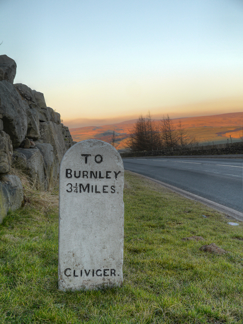
Milestone on the A671
Milestone at the side of Bacup Road (A671) near the entrance to Deerplay Quarry.
TO
BURNLEY
3¼ MILES
CLIVIGER
(Cliviger is a civil parish within the Borough of Burnley)
TO
BURNLEY
3¼ MILES
CLIVIGER
(Cliviger is a civil parish within the Borough of Burnley)
 Map © Crown Copyright")
TIP: Click the map for more Large scale mapping
- Grid Square
- SD8528, 85 images (more nearby 🔍)
- Photographer
- David Dixon (more nearby)
- Date Taken
- Tuesday, 19 February, 2013 (more nearby)
- Submitted
- Tuesday, 26 February, 2013
- Subject Location
-
OSGB36:
 SD 8594 2843 [10m precision]
WGS84: 53:45.1226N 2:12.8821W - Camera Location
-
OSGB36: SD 8593 2842
- View Direction
- Northeast (about 45 degrees)